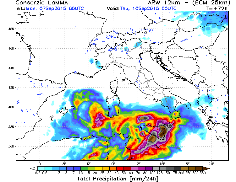
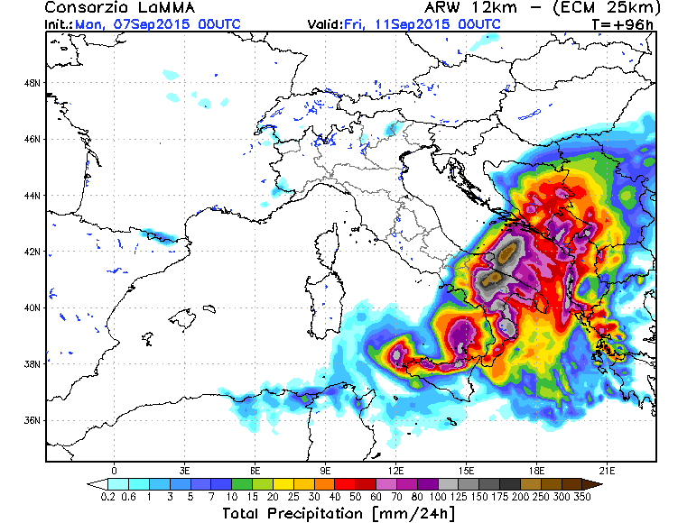
Jetzt tritt genau das ein, was Tobias schon erwähnt hat: Ein Unwetterträchtig warmes Mittelmeer. Schon vor Kurzem wurde Neapel "zugehagelt", nun scheints etwas südlicher noch krasser zu werden. Lokal werden 300mm Niederschlag erwartet! Unglaublich.
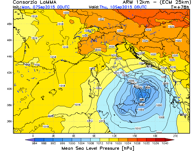
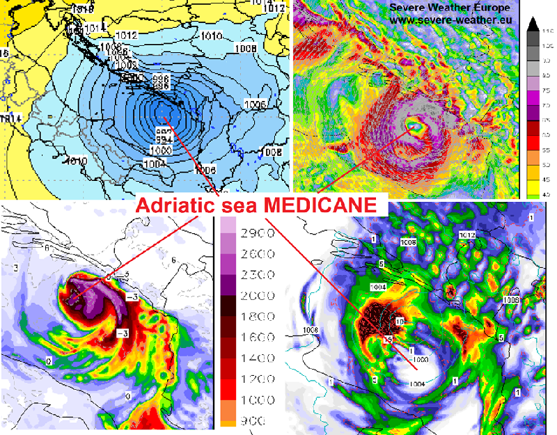
A very interesting, but potentially dangerous setup is shaping up for Thu-Fri this week across southern Italy and surrounding areas. As a response to a weak upper low crossing the southern Mediterranean, a surface low develops near Sicily and moves towards the southern Adriatic sea. Some high resolution models hint it could develop a warm core structure, but yet to be confirmed through the next model runs. In any case, the system could bring severe storms and damaging flash floods in these areas. Locally a few hundred mm of rainfall could cause damaging landslides and life treatening situations! Stay tuned for more updates!
Source: lamma WRF

")
